On the fjord
Wordless Wednesday
On Saturday, I took a tour with the MS Bruvik, the same boat that once ferried me to summer camp when I was about 10 years old. Back then it was just a boat ride. Now it was a historical adventure in several ways.
I live close to the city center of Bergen now, just 10-15 minutes by bus. As a child, I lived a short hour's bus ride outside of town. Going into the city then was a project. The first village we lived in was Salhus, a place that exists because of a waterfall that gave power to a textile factory. The factory sat right on the waterfront, and a little ferry ran across the fjord to Frekhaug. A road leading from Salhus to Hordvik, the second village we lived in when I was a child, wasn't built until the war years, engineered by Germans and built by Russian prisoners of war. There was a road going the other way, south towards town, but boat was best.
MS Bruvik was one of the passenger boats taking people, mail and goods up and down the fjord. It is now a vintage boat, run by a charity, and kept in good condition. And on our way up the fjord from Bergen, the captain had to quickly avoid another vessel and so I discovered that the boat responded really fast and maneuvered well.
We used to be connected by ferries across the fjord, but no longer. Cars and bridges have replaced the boats, although some folks still travel by catamaran to get to work.
Norway's (and Northern Europe's) largest inland island is Osterøy. There is no driving around the island or across it. Its terrain is too wild and rugged for that, and because the mountainsides sheering into the fjords give no natural harbor, crossing by boat to and from the island is limited. Most of the population lives to the west and north on the island, next to Sørfjorden and Osterfjorden. Where those fjords meet, they join the fjord coming up from Bergen. Nature's intersection, and one I crossed by ferry quite frequently as a child, to visit relatives.

These fjords are fed by rivers, one of which goes all the way to the inland town of Voss. And that river is the spawning river of the "Vossalaks" or Voss salmon. Salmon always return to the same river they hatched in, to create the next generation. Each river ends up with a unique subspecies of salmon. The Saturday trip was to go see a restored salmon perch at Kleiveland farm on Osterøy, on the Osterfjord. People would set a net out in the fjord below, and keep watch from the perch high above. They were waiting for the big Vossalaks to be caught. By the late 1980's, the Voss salmon population was collapsing, and salmon fishing in the fjords was banned in 1993. The salmon perches ("laksegilje") were abandoned and eventually torn down if they didn't fall down on their own.
Eager volunteers are rebuilding three, to show the history of the fjords and as a nod to our connection to nature as our provider. (There used to be 93 of them around the entire island.) UNESCO has been petitioned to put the entire fjord area around Osterøy and the island itself onto UNESCO' biosphere reserve list by 2019. It will be Norway's first entry on that list.
As I listened to the speeches as we were docked at a laksegilje, I went from seeing the fjords as just an opportunity to buy candy onboard the ferry to realizing their centuries-old role as highway and pantry, making it possible to make a living in what may look like the most inhospitable and inaccessible places. "Fjord" doesn't actually mean a body of water, but "way" or "travel route" by water.
What was the weather like? Quite varied. Check out the next photos!


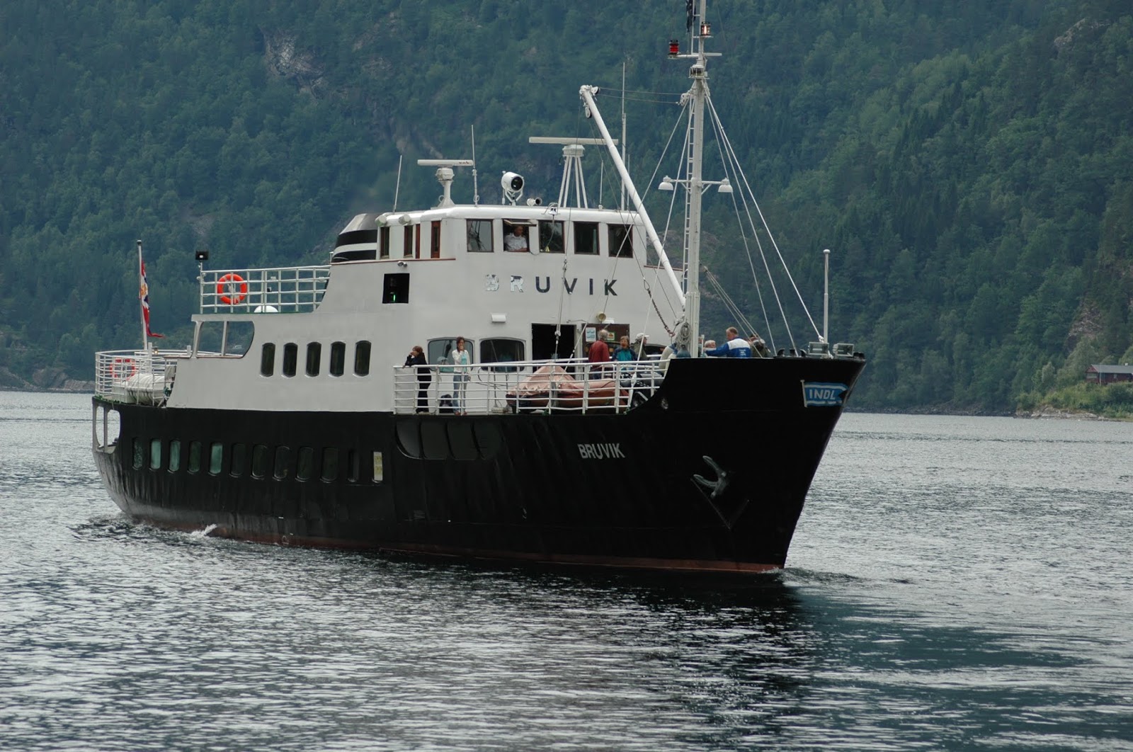 |
| MS Bruvik |
On Saturday, I took a tour with the MS Bruvik, the same boat that once ferried me to summer camp when I was about 10 years old. Back then it was just a boat ride. Now it was a historical adventure in several ways.
I live close to the city center of Bergen now, just 10-15 minutes by bus. As a child, I lived a short hour's bus ride outside of town. Going into the city then was a project. The first village we lived in was Salhus, a place that exists because of a waterfall that gave power to a textile factory. The factory sat right on the waterfront, and a little ferry ran across the fjord to Frekhaug. A road leading from Salhus to Hordvik, the second village we lived in when I was a child, wasn't built until the war years, engineered by Germans and built by Russian prisoners of war. There was a road going the other way, south towards town, but boat was best.
MS Bruvik was one of the passenger boats taking people, mail and goods up and down the fjord. It is now a vintage boat, run by a charity, and kept in good condition. And on our way up the fjord from Bergen, the captain had to quickly avoid another vessel and so I discovered that the boat responded really fast and maneuvered well.
We used to be connected by ferries across the fjord, but no longer. Cars and bridges have replaced the boats, although some folks still travel by catamaran to get to work.
Norway's (and Northern Europe's) largest inland island is Osterøy. There is no driving around the island or across it. Its terrain is too wild and rugged for that, and because the mountainsides sheering into the fjords give no natural harbor, crossing by boat to and from the island is limited. Most of the population lives to the west and north on the island, next to Sørfjorden and Osterfjorden. Where those fjords meet, they join the fjord coming up from Bergen. Nature's intersection, and one I crossed by ferry quite frequently as a child, to visit relatives.

 |
| Looking southeast towards Osterøy as we go northwest into Osterfjord |
 |
| Replica salmon perch or "laksegilje" |
Eager volunteers are rebuilding three, to show the history of the fjords and as a nod to our connection to nature as our provider. (There used to be 93 of them around the entire island.) UNESCO has been petitioned to put the entire fjord area around Osterøy and the island itself onto UNESCO' biosphere reserve list by 2019. It will be Norway's first entry on that list.
As I listened to the speeches as we were docked at a laksegilje, I went from seeing the fjords as just an opportunity to buy candy onboard the ferry to realizing their centuries-old role as highway and pantry, making it possible to make a living in what may look like the most inhospitable and inaccessible places. "Fjord" doesn't actually mean a body of water, but "way" or "travel route" by water.
 |
| The steamship Oster |
What was the weather like? Quite varied. Check out the next photos!


Comments